Propagation of the June 23, 2001 Peru Tsunami:
Preliminary MOST Model Results
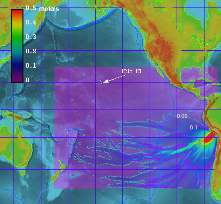
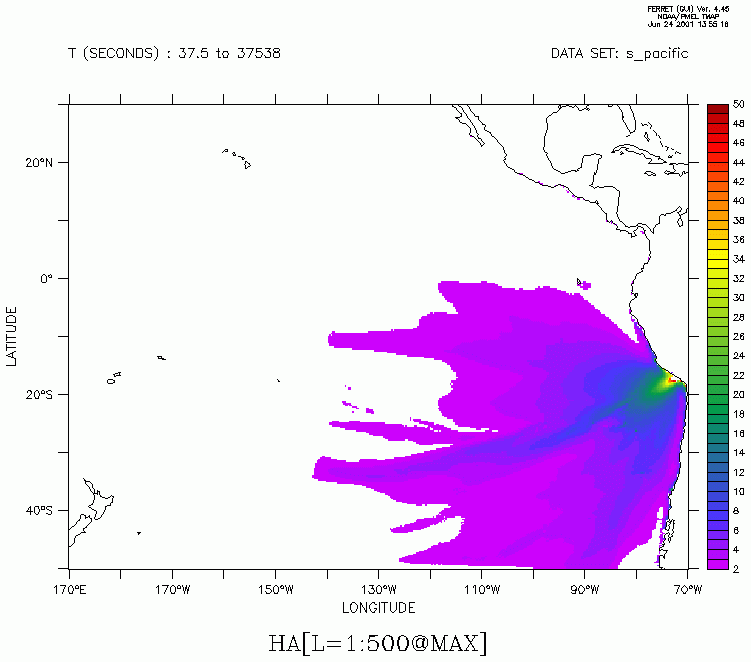
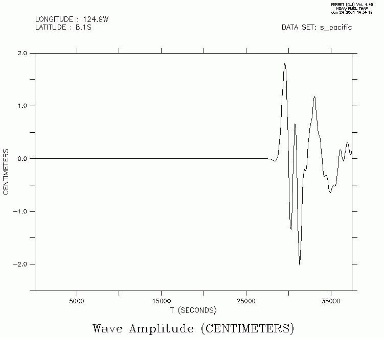
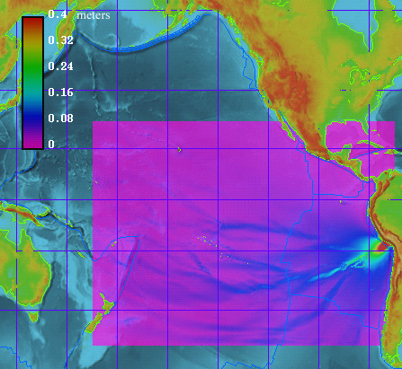
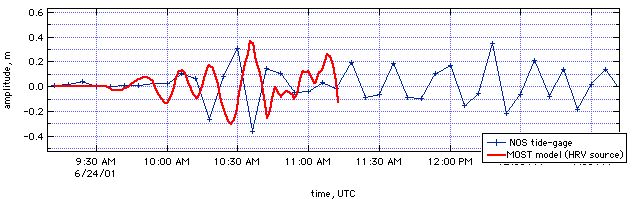
Tsunami source with revised CMT solution explains amplitudes at Hilo, HI
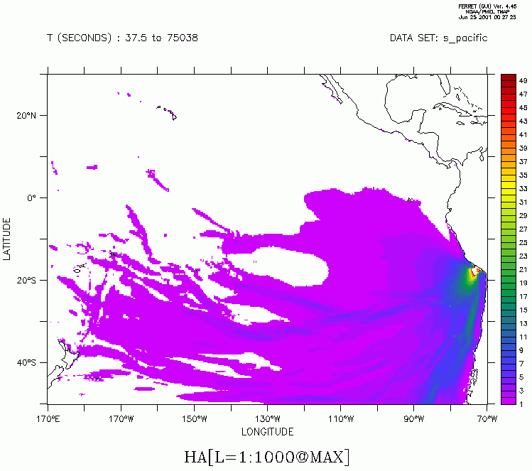
| Model: | MOST propagation model in spherical coordinate (Titov & Gonzalez,1997; Titov & Synolakis, 1998). Due to coarse grid resolution, only offshore wave propagation is modeled. Solid wall boundary conditions are set at 50m depth. |
| Bathymetry: | Derived from Smith & Sandwell 2min data. Resolution of the computational grid is variable.It is ~6min near equator and becomes finer when moving south. |
| Source: | CMT solutions from Harvard and USGS were used |
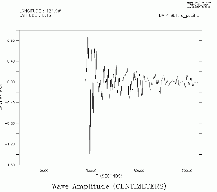
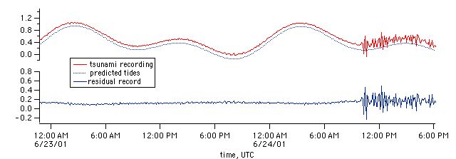
| Results: |
|
| References: | Titov, V.V., and F.I. Gonzalez (1997): Implementation and testing of the Method of Splitting Tsunami (MOST) model NOAA Technical Memorandum ERL PMEL-112, 11 pp.. (PDF) Titov, V. V.; Synolakis, C. E., 1998, Numerical modeling of tidal wave runup, Journal of Waterways, Ports, Coastal and Ocean Engineering, 124 (4), 157-171. |