Forecast Inundation Models
The objective of forecast inundation model development is to provide high resolution real-time tsunami predictions for selected coastal locations while the tsunami is propagating through the open ocean, before the waves have reached many coastlines. The forecast inundation models will be incorporated into the U.S. tsunami warning system for use at the Pacific and West Coast-Alaska Tsunami Warning Centers.
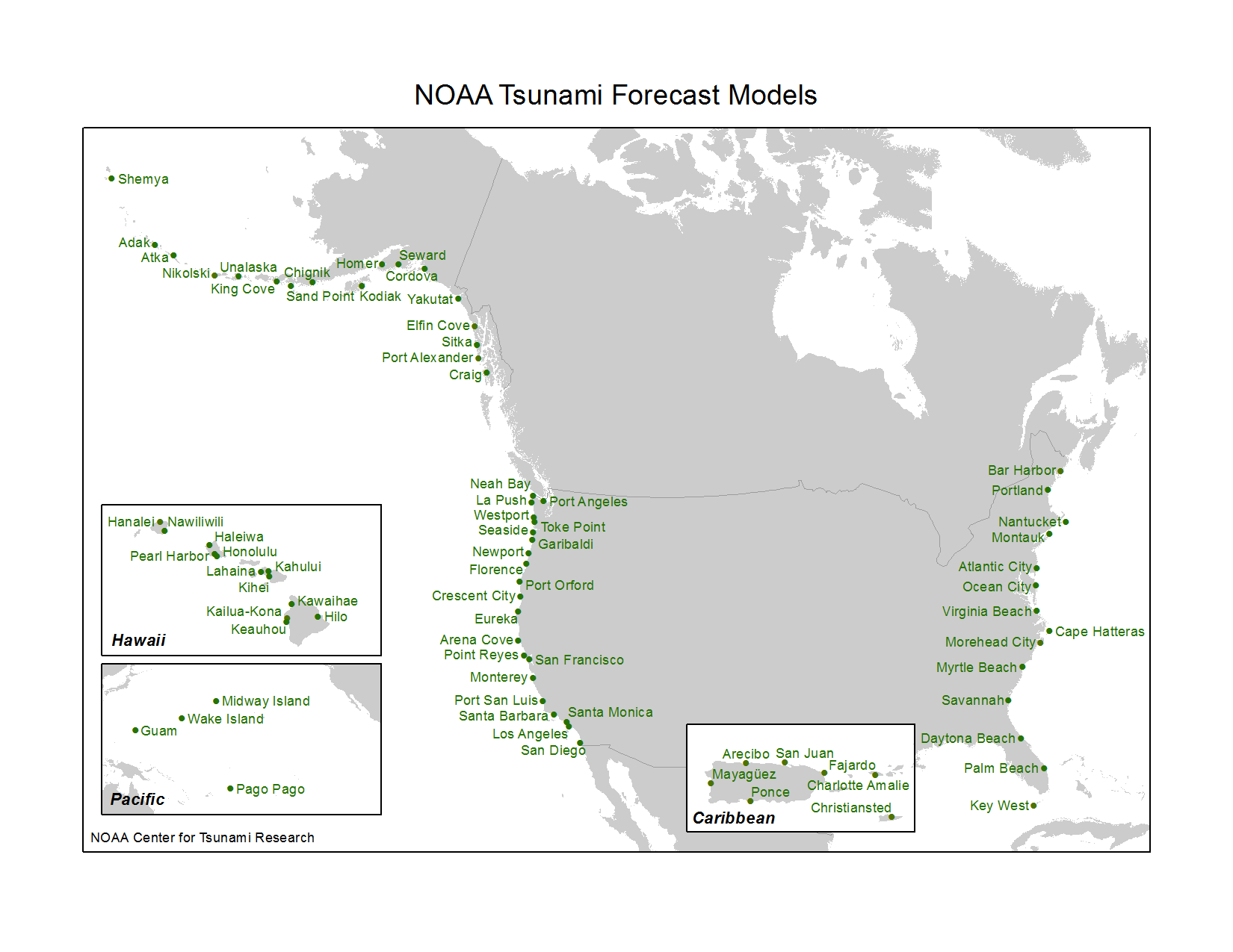 |
Location and development status of forecast inundation models (updated for FY12). |
Forecast inundation models combine the MOST tsunami forecast model with high-resolution topography and bathymetry which has been optimized for computation speed for selected coastal communities. These forecast models can be used in conjunction with a database of tsunami propagation in deep water to provide real-time wave height and current forecasts for a particular community during a tsunami event.
The development of a forecast model is derived from an initial high resolution inundation model and is typically divided into four main stages:
1. Creation of a high resolution reference model
The creation of a high resolution reference inundation model for the community under study is the first step in the creation of a forecast model for the community. These models can be used in non real-time tsunami calculations, for instance, to determine inundation lines from potential events. The coverage of the inundation model must be such that sufficient resolution is used to accurately resolve the wave dynamics in both deep and shallow areas. Grid boundaries should also extend into deep enough waters to allow for a seamless wave transition from the propagation database of tsunami runs in deep water into the high resolution local inundation model. These requirements do not generally pose a problem in the development of a high resolution reference model since these reference models are not intended to operate in real-time or under any type of time constraints. However, taking into consideration the operational nature of the forecast model to be designed, special attention should paid to ensure that grid coverage is sufficient to include all critical infrastructure in a particular community
2. Validation tests
The validity and accuracy of the high resolution model constructed during the first development stage is tested by comparing inundation extent and tide gage observations for well documented historical events. This process may involve the definition of a tsunami source for a particular event if one is not available, ideally based on deep ocean (DART) sea level measurements.
3. Forecast inundation model
After the high resolution reference model is evaluated and tested for accuracy, the model is then optimized to run fast and provide a forecast in real time. A reduction in grid coverage is performed, in which areas originally covered by the high resolution reference model grids, but with little influence on the overall wave dynamics, are excluded from the new grid coverage. Areas that allow for the reduction in grid resolution based on either water depth or tsunami wavelength are sub-sampled to reduce local grid resolution and speed up computations. Simulations of the same tsunami events previously used in the high resolution reference model validation are then run on the forecast inundation model, and results of both runs are compared. Special care is put into monitoring the inundation extent, and the deterioration of the tide gage time series when the lower resolution forecast model is used. A certain amount of loss of accuracy is expected, but the overall wave behavior should still be accurately reflected in the forecast inundation model results.
4. Robustness and stability of the forecast Inundation model
The last stage of forecast model development requires testing the developed forecast model for robustness to ensure the correct performance of the forecast models in an operational environment in which tsunamis of any magnitude, striking from any direction are possible. All developed forecast inundation models are put through a series of robustness tests in which their response to a set of large synthetic tsunamis triggered by hypothetical seismic events with magnitudes, Mw ~9.3 and Mw ~7.5, and positioned all along the various Pacific Ocean subduction zones is examined. These artificial seismic events are intended to represent worst-case and micro scenarios, and are simulated at each developed forecast inundation model location for a total of 24 hours of tsunami activity. The models must remain stable during the entire simulation for all events.