1992 Cape Mendocino Tsunami
 1 of 3 1 of 3   |
|
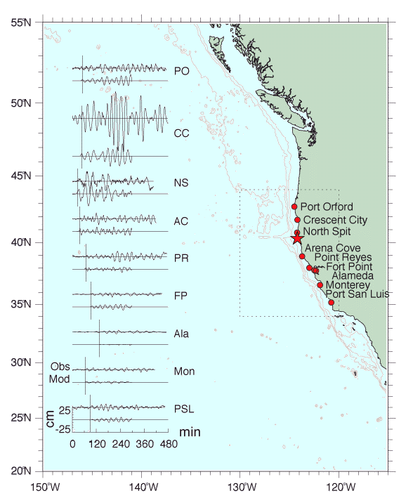
Tide Gauge Location Chart Summary chart presenting observed (top) and computed (bottom) time series for nine tide gauge stations along the coasts of California and Oregon. Vertical axes are deviation from background sea level in cm; horizontal axes are minutes of elapsed time after the main shock, with a vertical line indicating the computed arrival time at each station. Bathymetric contour interval is one kilometer. The dotted line rectangle denotes the numerical model computational region. Cape Mendocino is just south of North Spit, and the solid star marks the earthquake epicenter. Note that, at Crescent City (CC), the first wave packet arrives within minutes of the computed travel time (vertical line); this is the non-trapped tsunami energy, which traverses deep offshore water. Three hours after this first arrival, the largest observed tsunami wave is recorded at this station; this second tsunami wave packet corresponds to the trapped edge wave mode. |
|
 |
version |