NOAA NCTR research product Not an official forecast |
Simulated Cascadia Tsunami Event
Main Event Page
Cascadia Simulated Event Page | Simulated Sea Level Plots
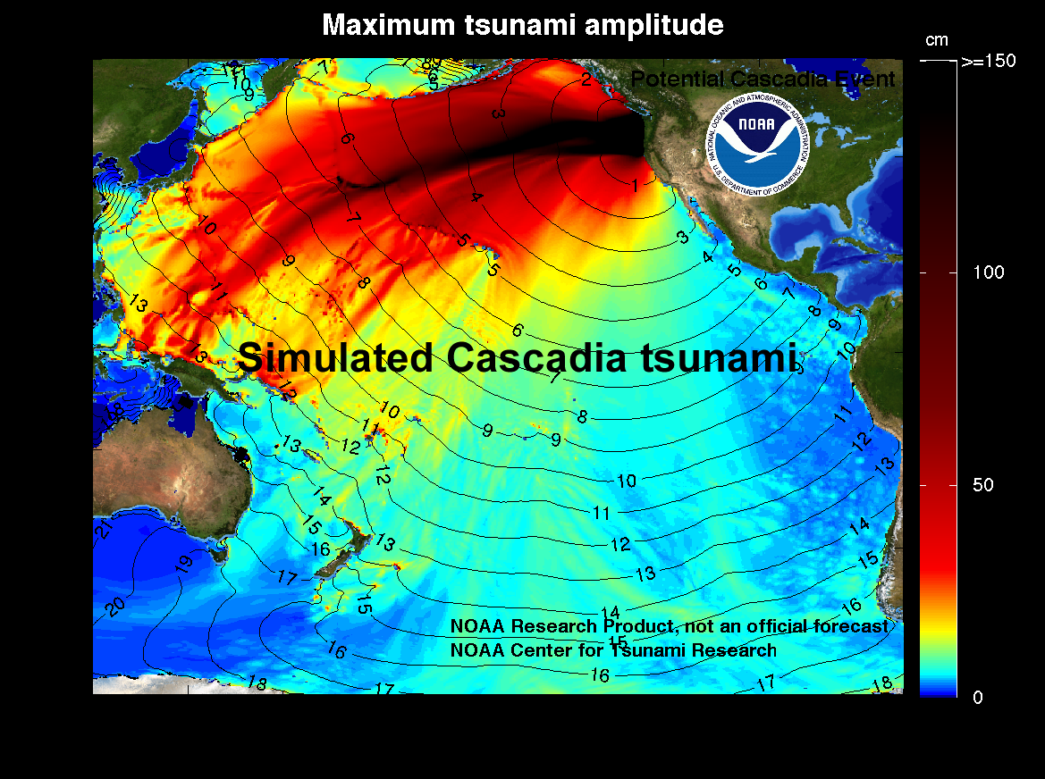
This hypothetical Cascadia tsunami is assumed to be generated by a Mw 9.0 earthquake off the Pacific Northwest Coast of the U.S. The length of the rupture is estimated to be 1000 km with a width of 83 km. In approximately 15 minutes, the tsunami would be first recorded at tsunameter/DART® buoys 46404, 46407, 46411 and 46419. Model results shown below were created with the NOAA forecast method using MOST model with the tsunami source as described in Witter et al. (2011). |
||
The graphics display research model results, showing qualitative and quantitative information about the tsunami, including tsunami wave interaction with ocean floor bathymetric features, and neighboring coastlines. Tsunami model amplitude information is shown color-coded according to the scale bar. Offshore tsunami wave amplitude was estimated based on the source described by Witter et al. (2011). Modeling Results
Preparedness Links for Washington State
|
||
References
Witter, R.C., Y. Zhang, K. Wang, G.R. Priest, C. Goldfinger, L.L. Stimely, J.T. English, and P.A. Ferro (2011), Simulating Tsunami Inundation at Bandon, Coos County, Oregon, Using Hypothetical Cascadia and Alaska Earthquake Scenarios, Special Paper 43, Oregon Department of Geology and Mineral Industries, 63 pages.
Disclaimer: The model simulations on these pages show the results of ongoing research to enhance tsunami science and to improve NOAA operational tsunami forecasts. These products are intended for research use and are not an official forecast. They should not be used as the basis of any public or private policy decisions.
For media inquiries:
When using information from this page, please credit NOAA / PMEL / Center for Tsunami Research