Not an official forecast
Tsunami Event - July 17, 1998 Papua New Guinea
Main Event Page
Preliminary Numerical Simulations
1 Minute Tide Gaga Data (PDF)
These tide gage data were downloaded via modem, from individual stations maintained by NOAA's National Ocean Service. No editing or quality control has been performed.
2 or 4 Minute Tide Gage Data (PDF)
These tide gage data were downloaded via ftp from the Pacific Tsunami Warning Center, NWS. Minimal editing was done and no quality control has been performed.
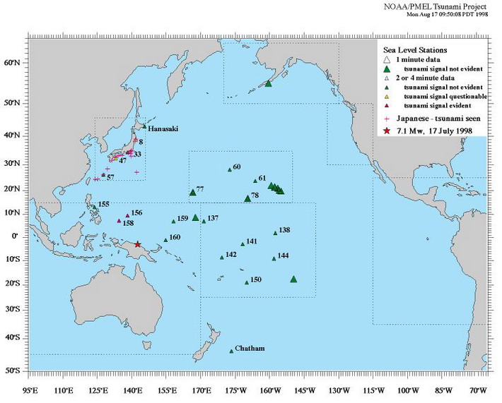
The data have been reformatted and 2 hour high-pass filtered. The numbers on the plots refer to chart numbers on area maps. See Chart of Station Locations (PDF) - with clickable area maps.
The data (except JMA data) are available: FTP information and site.
Station Summary Map (PDF version)
Further Information of this Tsunami
- Compilation of Web-Links by Type of Data
- Earthquake near the north coast of New Guinea, Papua New Guinea - USGS
For media inquiries:
When using information from this page, please credit NOAA / PMEL / Center for Tsunami Research