Tsunami Forecasting
Emergency managers and officials need fast, accurate tsunami forecasts. Forecasts support evacuation orders and other decisions necessary when lives and property are at stake. Advances in earthquake detection, rapid tsunami assessment, and modeling technology are integrated to create an effective tsunami forecasting system.
The NOAA inundation forecasting system
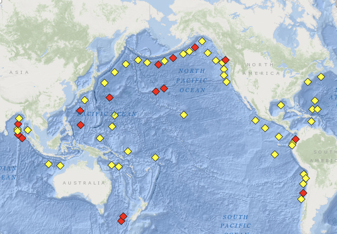
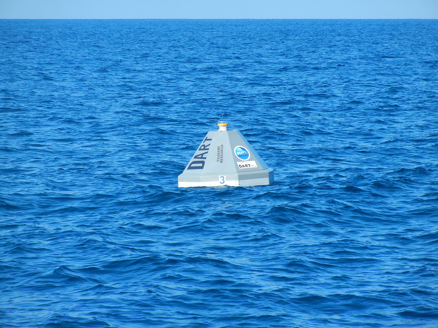
The NOAA Center for Tsunami Research developed and maintains the Short-term Inundation Forecasting for Tsunamis (SIFT) system, which provides forecasts used for operations by NOAA's Pacific and National Tsunami Warning Centers. A SIFT forecast is an estimate of tsunami amplitudes, flow velocities, and arrival times for offshore, coastal, and inundation areas made by constraining real-time tsunami observations for specific coastal areas. Forecast inundation models for U.S. coastal areas are created while the tsunami is propagating through the open ocean, before the waves have reached many coastlines.
A combination of sensing, measurement, and modeling provides reliable tsunami forecasts
To forecast inundation from early tsunami waves, seismic estimates and tsunami measurements are compared to a database of pre-computed generation/propagation forecasts to select the best (linear) combination of scenarios that most closely match the observed data and provide inundation forecasts. The SIFT workflow has the following steps:
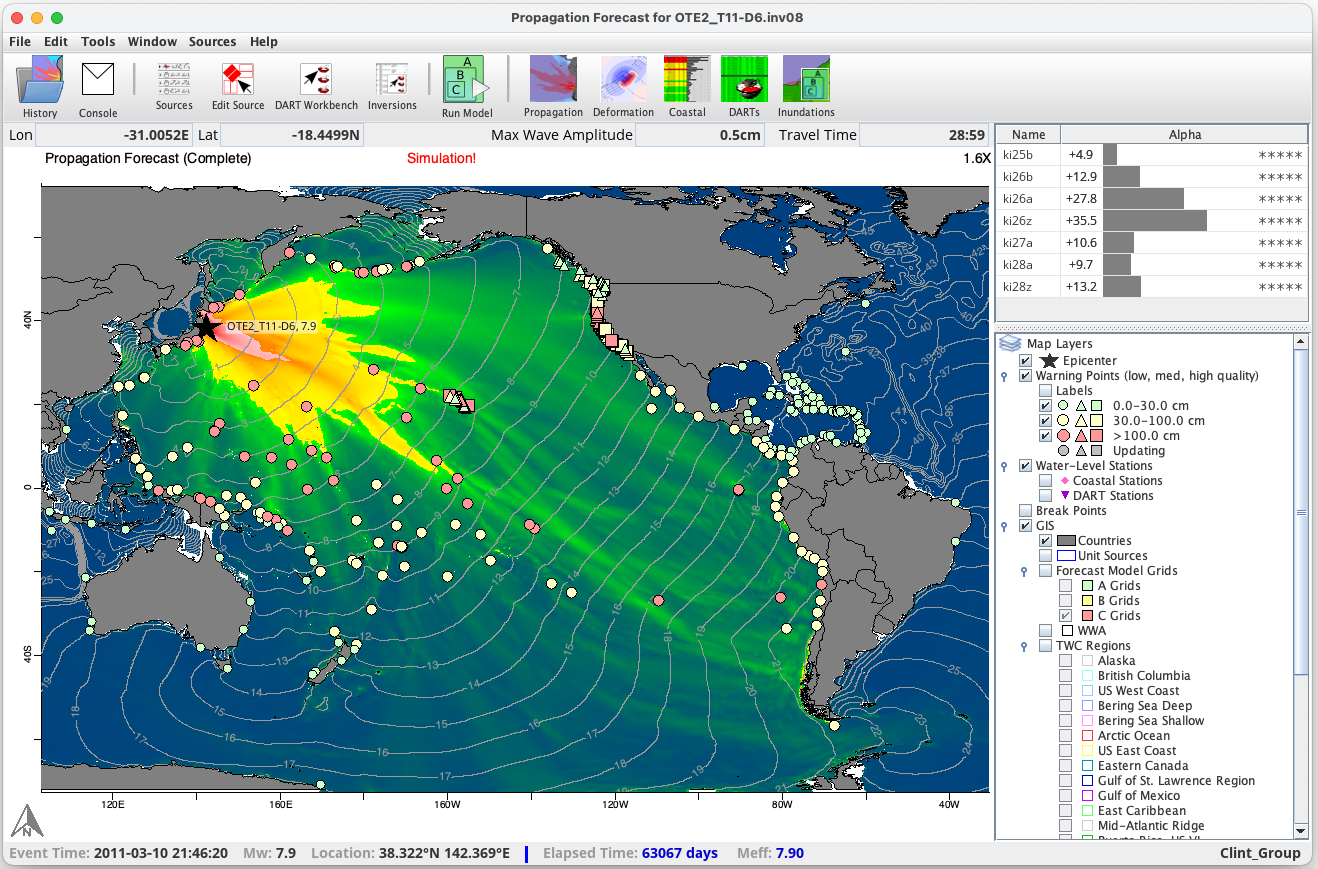
A propagation forecast window is displayed when SIFT detects a tsunami. Propagation of the waves from the earthquake source is shown quickly. The map is automatically updated when a new forecast that matches the tsunami in the deep ocean is determined.
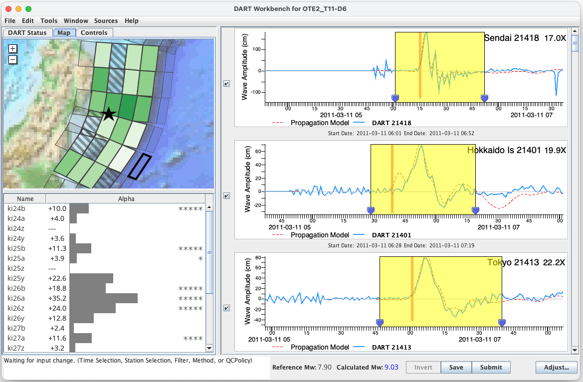
DART Workbench is the interface used to derive a tsunami source. Model predictions run with placeholder sources and stored in a database are replaced by a source that forces the model to match measured tsunami waves (yellow box). The new source is shown on a map and in a table.
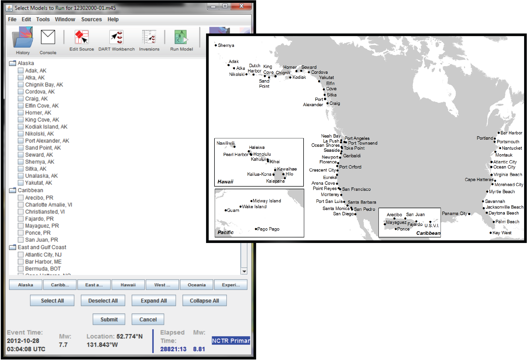
Flooding models to run are chosen in the forecast model selection window. Any finite number of models or the full set of 77 can be selected and run at any time.
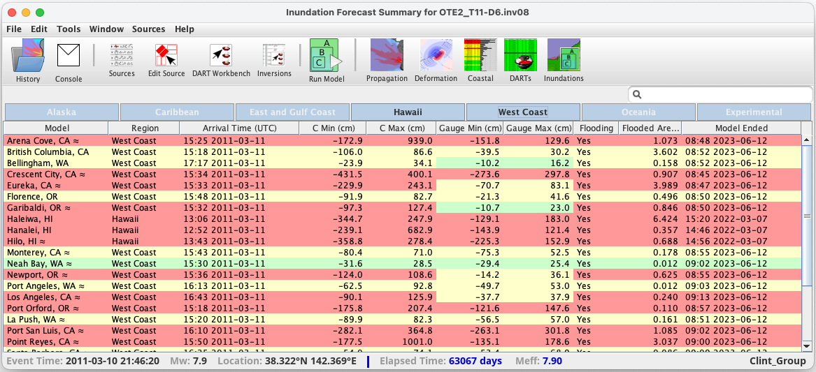
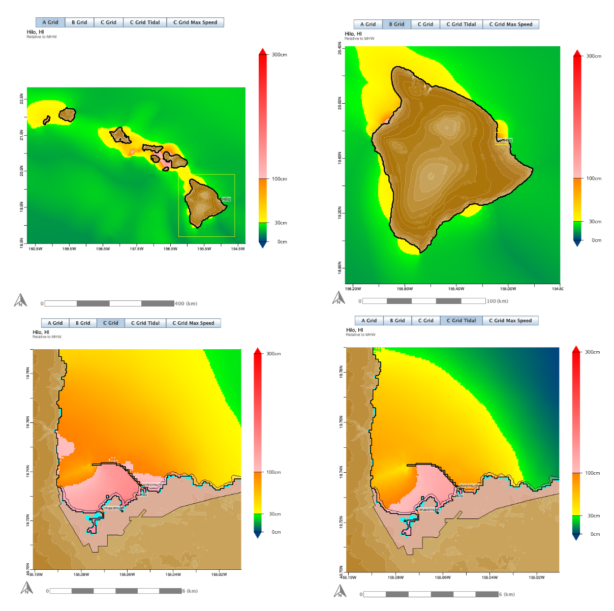
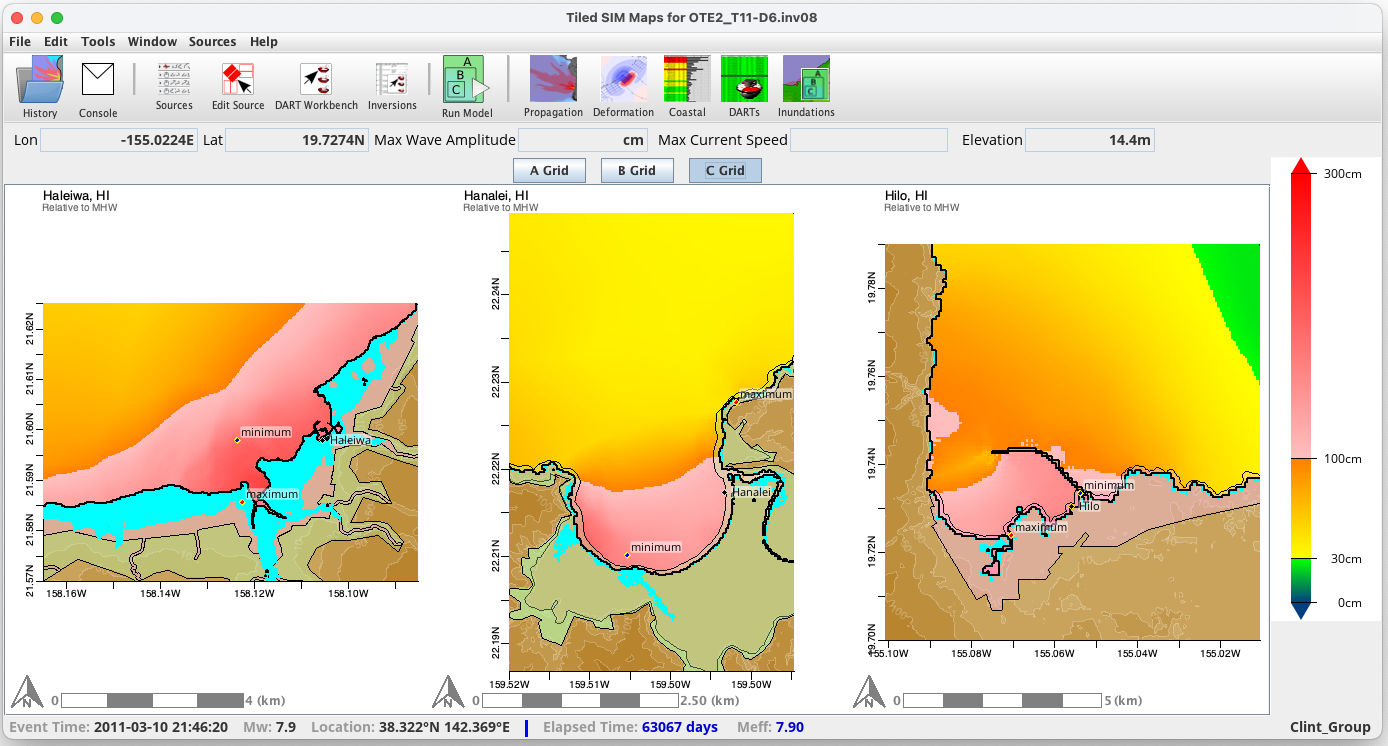
Propagation and flooding forecasts are displayed in both tabular and graphical formats at locations predefined by NOAA Tsunami Warning Centers.
![]() YouTube videos about tsunami detection and forecasting
YouTube videos about tsunami detection and forecasting