NOAA NCTR research product Not an official forecast |
Tsunami Event Series - October 7, 2009 Vanuatu and Santa Cruz Islands
Main Event Page
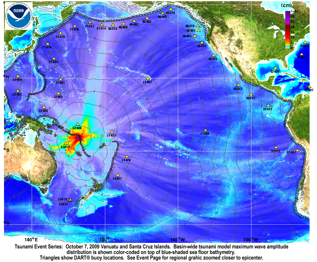
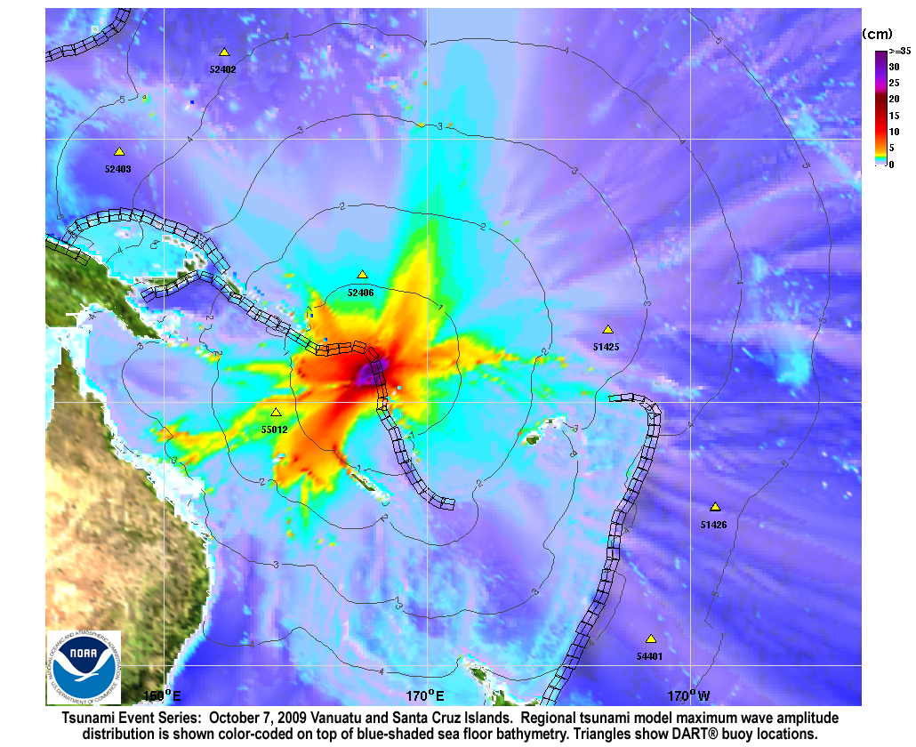
Two tsunamis were generated by a Mw 7.7 earthquake (13.006°S 166.510°E ), at 22:03:14 UTC, 295 km (180 miles) NNW of Luganville, Espiritu Santo, Vanuatu (according to the USGS) and a Mw 7.8 earthquake in the Santa Cruz Islands (12.517°S 166.382°E), at 22:18:51 UTC, 340 km (210 miles) NNW of Luganville, Espiritu Santo, Vanuatu (according to the USGS). In a little over an hour, the tsunami waves were recorded at the Australian owned and operated DART® station 55012 in the Coral Sea , which was built by SAIC. An inversion based on the DART® record clearly indicates that the first two distinct waves were generated by two consecutive earthquakes 15 minutes apart. The inversion results also characterized a stronger tsunami source for the second Santa Cruz earthquake than the first Vanuatu earthquake. |
||
| Forecast results below, and in the slideshow, were
created by jointly simulating the two tsunamis with the
NOAA forecast method using
MOST model with the tsunami source
inferred from DART® data. Graphics and animations : The graphics to the left display forecast results, showing qualitative and quantitative information about the tsunami, including tsunami wave interaction with ocean floor bathymetric features, and neighboring coastlines.
Unit Sources: 2.81*nt38b |
||
For media inquiries:
When using information from this page, please credit NOAA / PMEL / Center for Tsunami Research