NOAA NCTR research product Not an official forecast |
Main Event Page
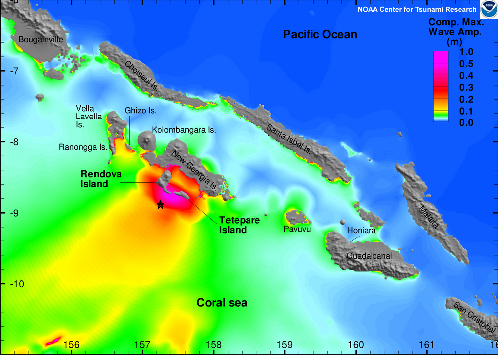
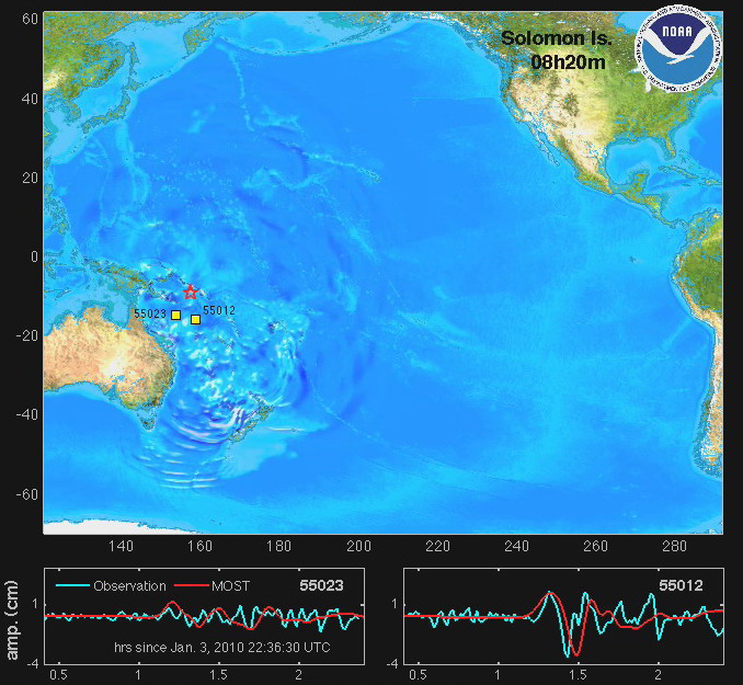
The Solomon Islands tsunami was generated by a Mw 7.1 earthquake (8.800°S, 157.370°E ), at 22:36:28 UTC, 105 km (65 miles) SSE of Gizo, New Georgia Islands, Solomon Isl. (according to the USGS). In approximately an hour 15 min, and an hour 30 min, respectively, the tsunami was recorded at DART® buoys 55023 and 55012. Forecast results shown below were created with the NOAA forecast method using MOST model with the tsunami source inferred from DART® data. |
||
The graphics to the left display forecast results, showing qualitative and quantitative information about the tsunami, including tsunami wave interaction with ocean floor bathymetric features, and neighboring coastlines. Tsunami model amplitude information is shown color-coded on top of blue-shaded sea floor bathymetry. The tsunami waves first arrived at Honiara, Solomon Islands, (approximately 300 km southeast from earthquake epicenter) earlier than other tide gages, at 23:29 UTC, about 53 minutes after the earthquake. Local Modeling Results
Model and DART® buoy data / tide gage data comparison |
||
Disclaimer: The forecasts on these pages show the results of ongoing research to enhance tsunami science and to improve NOAA operational tsunami forecasts. These products were developed during or shortly after the tsunami event, are intended for research use, and are not an official forecast. They should not be used as the basis of any public or private policy decisions. Please contact NCTR to find if there are more detailed follow-on analysis results.
For media inquiries:
When using information from this page, please credit NOAA / PMEL / Center for Tsunami Research