Models used for Inundation Mapping
The NCTR monitors advances in tsunami modeling and incorporates improved technology into its inundation mapping efforts. Coastal states may use various hydrodynamic numerical models for calculating tsunami inundation. MOST Finite Difference Model The MOST (Method of Splitting Tsunami) model, developed by Titov of PMEL and Synolakis of University of Southern California, uses a finite difference method to divide its computational domain. MOST is the standard model used at the NCTR. for more information: An animation of tsunami inundation in Seattle displays results using the MOST model. For more animations of inundation model results, check out the Washington animation page |
 MOST computational domain |
The TUNAMI-N2 (Tohoku University's Numerical Analysis Model for Investigation of Near field tsunamis) model, developed by the Disaster Control Research Center of Tohoku University in Japan, also uses a finite difference method in its computations. It is currently being used in Hawaii.
Alaska also uses a finite difference model for its inundation maps. The state's model was developed by the Geophysical Institute at University of Alaska, Fairbanks.
Finite Element Model The ADCIRC model, as modified by Baptista and Myers, utilizes a finite element method to divide its computational domain. The ADCIRC model is currently being used by the Oregon Graduate Institute, to develop inundation maps in Oregon. An animation of tsunami inundation in Newport, Oregon displays the ADCIRC model results. |
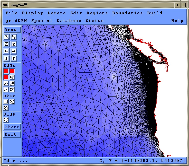 ADCIRC computational domain |