NOAA NCTR research product Not an official forecast |
|
Tsunami Event - July 17, 2006 South Java
Main Event Page
The South Java tsunami was generated by a Mw 7.7 earthquake (9.222°S 107.320°E), 2006-07-17 08:19:28 UTC, 230 km (145 miles) NE of Christmas Island (according to the USGS).
A preliminary simulation of 07/17/06 South Java event was performed with available seismic data. The earthquake origin is located at 107.263 deg (lon), -9.295 deg (lat). A 100x50 Km source is ruptured during the simulation with a slip amount of 2 meters. The fault 's Dip, Rake and Strike angles were 7, 67 and 270 deg respectively. The earthquake source was located 10 Km deep.
The image shows tsunami radiation pattern with color coded information about the max wave height at different locations throughout the Indian Ocean.
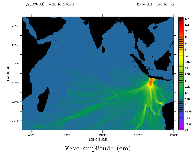
The following animation displays qualitative information about the tsunami propagation including tsunami wave interaction with ocean floor bathymetric features, and neighboring coastlines. The timer displays time elapsed since time of the earthquake, providing an estimate of tsunami arrival time at different locations.
Wave propagation animation (small version -- 2 MB)
Wave propagation animation (large version -- 67MB)
Unit Sources: 2.0*io41a
Links:
- Compilation of Web-Links
- Another tsunami wakeup call in the Indian Ocean,
Diego Arcas, NCTR scientist
For media inquiries:
When using information from this page, please credit NOAA / PMEL / Center for Tsunami Research