Not an official forecast
Tsunami Event Series - October 7, 2009 Vanuatu and Santa Cruz Islands
Main Event Page
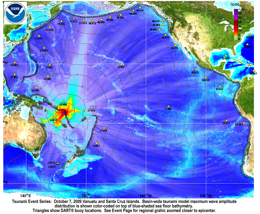
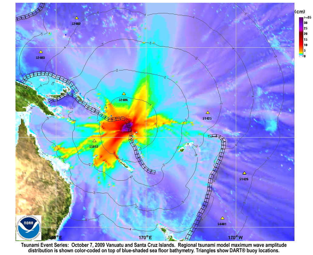
Two tsunamis were generated by a Mw 7.7 earthquake (13.006°S 166.510°E ), at 22:03:14 UTC, 295 km (180 miles) NNW of Luganville, Espiritu Santo, Vanuatu (according to the USGS) and a Mw 7.8 earthquake in the Santa Cruz Islands (12.517°S 166.382°E), at 22:18:51 UTC, 340 km (210 miles) NNW of Luganville, Espiritu Santo, Vanuatu (according to the USGS).
In a little over an hour, the tsunami waves were recorded at the Australian owned and operated DART® station 55012 in the Coral Sea , which was built by SAIC. An inversion based on the DART® record clearly indicates that the first two distinct waves were generated by two consecutive earthquakes 15 minutes apart. The inversion results also characterized a stronger tsunami source for the second Santa Cruz earthquake than the first Vanuatu earthquake.
Forecast results below, and in the slideshow, were created by jointly simulating the two tsunamis with the NOAA forecast method using MOST model with the tsunami source inferred from DART® data.
Graphics and animations:
The graphics to the left display forecast results, showing qualitative and quantitative information about the tsunami, including tsunami wave interaction with ocean floor bathymetric features, and neighboring coastlines.
- Tsunami model Maximum Wave Amplitude information is shown color-coded on top of blue-shaded sea floor bathymetry. Triangles indicate DART® buoy locations. Another graphic is zoomed closer to the epicenter.
- The Tsunami Propagation Animation (13.7 MB) shows propagation dynamics of the research forecast model computed with the MOST. created with the MOST forecast model.
- Model and DART® buoy data data comparison composite plots with explanatory annotations.
Unit Sources: 2.81*nt38b
For media inquiries:
When using information from this page, please credit NOAA / PMEL / Center for Tsunami Research