Inundation Mapping - Oregon Data Assessment
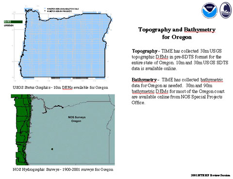
Topography - Thirty meter USGS topographic DEMs (digital elevation maps) in pre-SDTS format have been collected for the entire state of Oregon. 10m and 30m USGS SDTS data is available online.
Bathymetry - Bathymetric data has been collected for Oregon as needed. Thirty meter and 90m bathymetric DEMs for most of the Oregon coast are available online from NOS Special Projects Office.