Not an official forecast
Taiwan Tsunami, April 2, 2024
Main Event Page
The April 2, 2024, Taiwan tsunami was generated by a Mw 7.4 earthquake (23.819°N 121.562°E), at 2024-04-02 23:58:11 UTC (according to the USGS). The earthquake generated a tsunami that was detected by coastal sea-level gages in Taiwan and Japan, also in deep water by the Deep-ocean Assessment and Reporting of Tsunamis (DART) system. The closest coastal sea-level station at Hualien, Taiwan showed largest tsunami amplitudes with sea level changes starting immediately after the earthquake. The record shows water receding first to about -1.3 m, with the largest positive amplitude of 72 cm recorded 30 minutes after the earthquake. Several Taiwanese and Japanese coastal sea-level stations recorded tsunami arriving within an hour from the earthquake. The tsunami was detected in deep water approximately 1 hour 15 minutes after the earthquake at DART 52404, located approximately 1,200 km southeast of the epicenter. The next available DART buoys to detect the tsunami were DART 52405 and DART 21420, showing waves approximately 2 hours after the earthquake. The initial ocean surface deformation was derived from the USGS W-phase Moment Tensor (NP2 Nodal Plane) based on an elastic deformation approximation by Okada, 1985.
The graphics below display preliminary near-real-time modeling analysis, showing qualitative and quantitative information about the tsunami, including tsunami wave interaction with ocean floor bathymetric features, and neighboring coastlines. Tsunami model amplitude information is shown color-coded according to the scale bar.
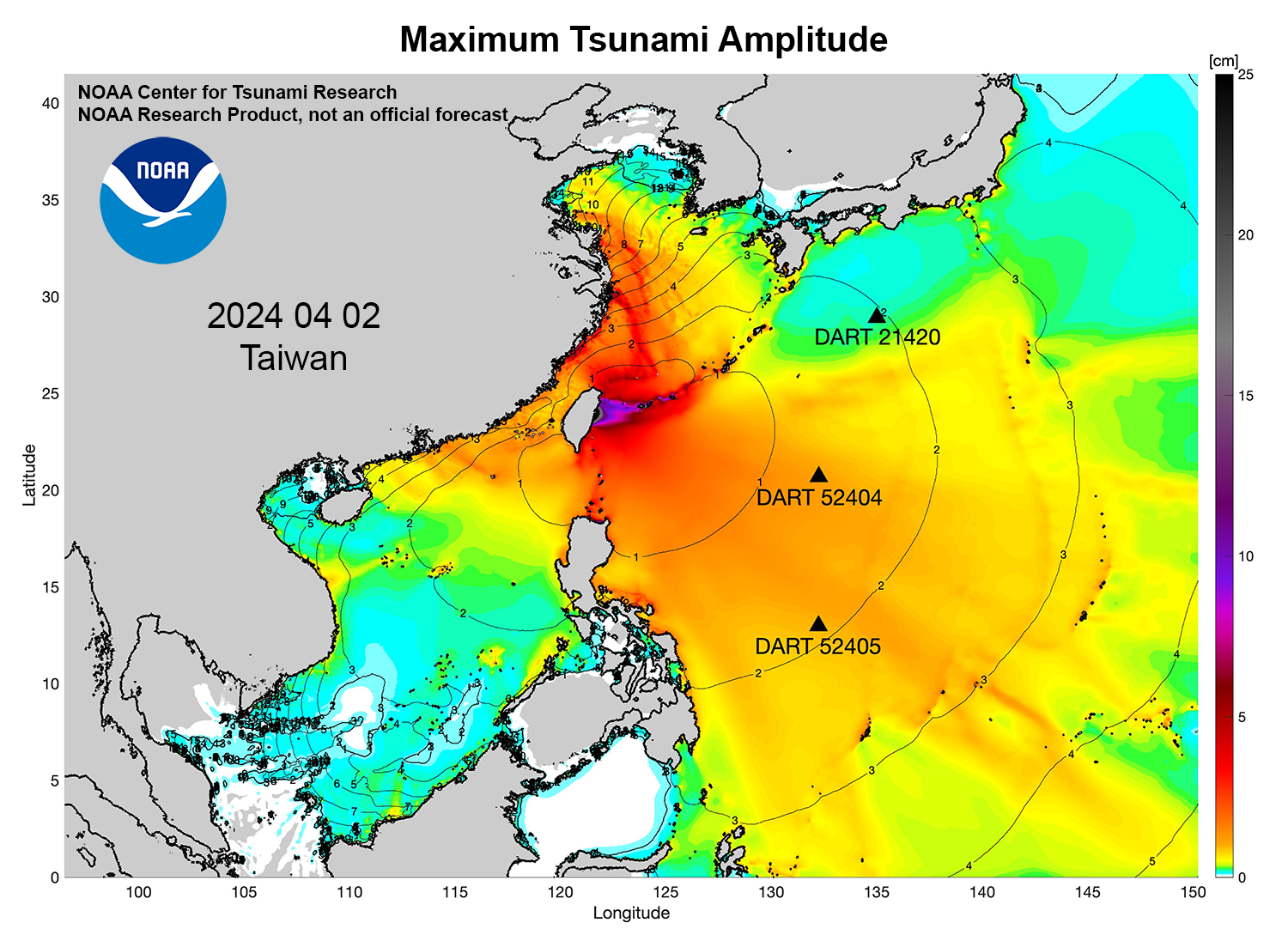
- Model amplitudes are calculated with the MOST forecast model. Filled colors show maximum computed tsunami amplitude in cm during 24 hours of wave propagation.
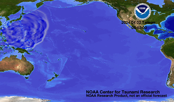
 Propagation animation on YouTube
Preliminary Model
Comparisons of the April 2, 2024 Taiwan tsunami recorded at tsunameter/DARTs and tide gauges with model results (red) are presented below.
- DART® comparisons with model data
- Composite plot: DARTs 52404, 52405, 21420
- Coastal sea-level gauge comparisons with model data
- Composite plot:
- Taiwan tide gauges: Hualien, Chenggong, Su'ao, Keelung, Houbihu, Donggang
- Japan tide gauges: Ishigaki, Naha
- Composite plot:
It is noted that all above model results are preliminary. The discrepancies between model results and tide gauge observation are mostly due to the limited knowledge of the earthquake/tsunami source configuration during the time of the analysis.
Disclaimer: The models on these pages show the results of ongoing research to enhance tsunami science and to improve NOAA operational tsunami forecasts. These products were developed during or shortly after the tsunami event, are intended for research use, and are not an official forecast. They should not be used as the basis of any public or private policy decisions. Please contact NCTR to find if there are more detailed follow-on analysis results.
For media inquiries:
When using information from this page, please credit NOAA / PMEL / Center for Tsunami Research