Not an official forecast
Tsunami Event - April 6, 2010 Sumatra
Main Event Page
Model and Data Comparison Plots
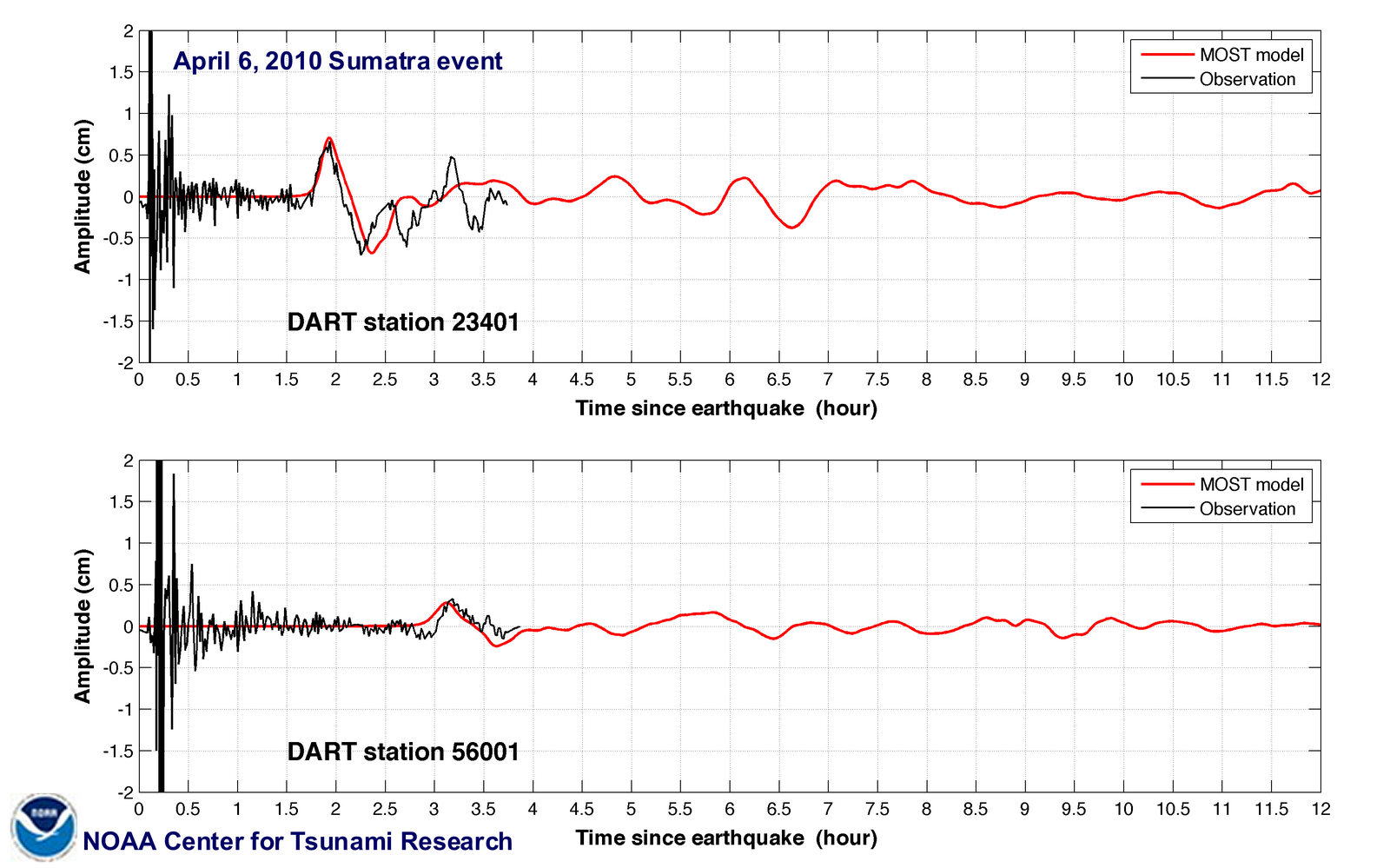
The Northern Sumatra, Indonesia tsunami was generated by a Mw 7.8 earthquake (2.360°N, 97.132°E ), at 22:15:02 UTC, 200 km (125 miles) WNW of Sibolga, Sumatra, Indonesia (according to the USGS). In a little under 2 hours, the tsunami was first recorded at DART® buoy 23401 and in a little over 3 hours, the tsunami was recorded at DART® buoy 56001. Forecast results shown below were created with the NOAA forecast method using MOST model with the tsunami source inferred from DART® data. The tsunami waves first arrived at Telukdalam (approximately 215 km southeast from the earthquake epicenter ), at 22:55 UTC, about 40 minutes after the earthquake.
The graphics to the left display forecast results, showing qualitative and quantitative information about the tsunami, including tsunami wave interaction with ocean floor bathymetric features, and neighboring coastlines. Tsunami model amplitude information is shown color-coded according the scale bar.
- Energy propagation pattern of the 6 April 2010 tsunami calculated with MOST forecast model. Filled colors show maximum computed tsunami amplitude in cm during 24 hours of wave propagation. Black contours show computed tsunami arrival time.
- Propagation animation
- Regional modeling results for Northern Sumatra
Model results comparison with sea level data
- Individual comparison plots available from Google map
- DART® 23401 and 56001 composite plot
- Unit Sources: 0.44*io23a+1.21*io23x+1.26*io23z
Disclaimer: The forecasts on these pages show the results of ongoing research to enhance tsunami science and to improve NOAA operational tsunami forecasts. These products were developed during or shortly after the tsunami event, are intended for research use, and are not an official forecast. They should not be used as the basis of any public or private policy decisions. Please contact NCTR to find if there are more detailed follow-on analysis results.
For media inquiries:
When using information from this page, please credit NOAA / PMEL / Center for Tsunami Research