Puget Sound Tidal Datum Distributions: Geospatial Data
Introduction
The NOAA Pacific Marine Environmental Laboratory Center for Tsunami Inundation Mapping Efforts developed tidal datum distributions for Puget Sound, Washington, based on a harmonic constant datum method described in Mofjeld, et al. (2003). These data were developed for the purpose of developing high resolution digital elevation models for use tsunami inundation modeling and are associated with the following publication:
Revisions
There is no plan to update the data on this site at this time.
Data Formats
Data are provided in ESRI ArcGIS shapefile or ascii text format. Metadata associated with each file provide more details on the data sources, development procedures, and projection information. The data were compiled in ESRI ArcView 3.2.
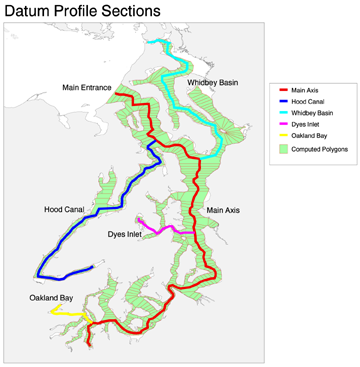
Data include the following:
- ps_model -- Computed polygons with tidal datum distributions
- ps_polynode -- Points representing all nodes used to create polygons
- ps_regions -- Polygons representing the regions discussed in the report
- ps_tidesta -- Points representing the location of water level stations
The shoreline used in the Puget Sound Tidal Model can be obtained through the Washington State Department of Ecology
Acknowledgments
This project was partially funded by the National Tsunami Hazard Mitigation Program to develop tsunami inundation maps for at-risk U.S. coastal communities. The development of these data were also partially supported by the Joint Institute for the Study of the Atmosphere and Ocean (JISAO) under NOAA Cooperative Agreement NA67RJO155, JISAO Contribution No. 959, PMEL Contribution No. 2533.
References
Mofjeld, H.O., A.J. Venturato, F.I. Gonzalez, V.V. Titov, and J.C. Newman (2004): The Harmonic Constant Datum Method: Options for Overcoming Datum Discontinuities at Mixed-Diurnal Tidal Transitions. J. Atmos. Ocean. Technol., 21(1), 95-104.