Not an official forecast
Gisborne, New Zealand Tsunami, September 1, 2016
Main Event Page
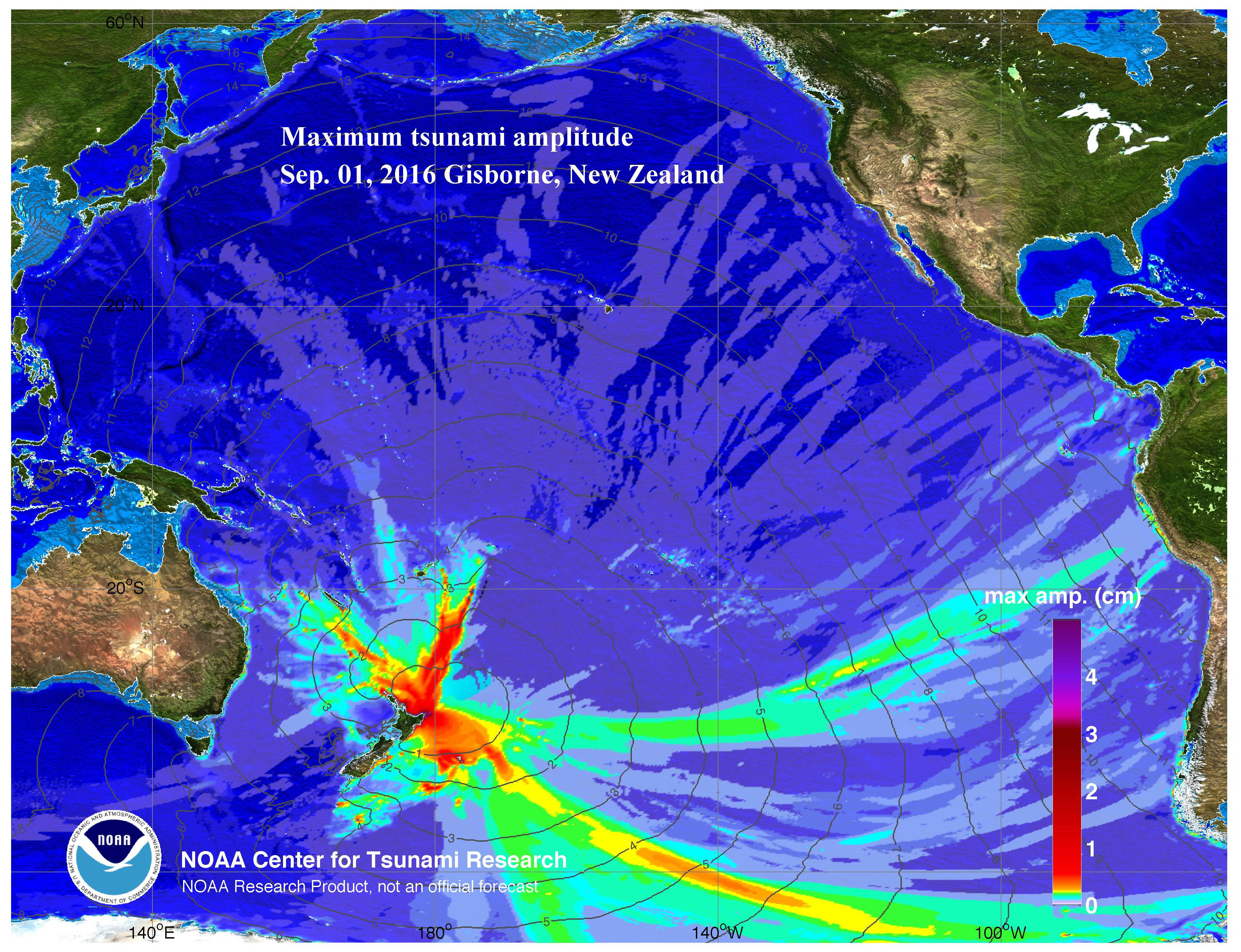
The Gisborne, New Zealand tsunami was generated by a Mw 7.1 earthquake (37.401°S 179.055°E), at 2016-09-01 16:37:57 UTC,166 km (103.1 mi) NE of Gisborne, New Zealand (according to the USGS). Approximately 9 minutes later, the tsunami was recorded at East Cape tide gauge, New Zealand. Forecast results shown below were created with the NOAA forecast method using MOST model with the tsunami source inferred from epicenter location and magnitude (Mw 7.1) of the earthquake.
The graphics display research forecast results, showing qualitative and quantitative information about the tsunami, including tsunami wave interaction with ocean floor bathymetric features, and neighboring coastlines. Tsunami model amplitude information is shown color-coded according to the scale bar.
- Model amplitudes calculated with the MOST forecast model. Filled colors show maximum computed tsunami amplitude in cm during 24 hours of wave propagation.
 Propagation animation on YouTube and .mp4 format
Model and tide gauge sea level data comparisons
Comparison of the September 1, 2016 Gisborne, New Zealand tsunami recorded at near-field tide gauges with model results. The model time series are obtained from hindcast model simulation, with source deformation computed using the USGS Moment Tensor solution.
- Tide gauge comparisons with model data
- Preliminary model source parameters:
Length = 60 km, Width = 40 km, Depth = 19 km, Strike = 351, Dip = 26, Rake = -145, Slip = 0.6 m
Disclaimer: The models on these pages show the results of ongoing research to enhance tsunami science and to improve NOAA operational tsunami forecasts. These products were developed during or shortly after the tsunami event, are intended for research use, and are not an official forecast. They should not be used as the basis of any public or private policy decisions. Please contact NCTR to find if there are more detailed follow-on analysis results.
For media inquiries:
When using information from this page, please credit NOAA / PMEL / Center for Tsunami Research