Not an official forecast
Aquila, Mexico Tsunami, September 19, 2022
Main Event Page
The September 19, 2022, Mexico tsunami was generated by a Mw 7.6 earthquake (18.367°N 103.252°W), at 2022-09-19 18:05:06 UTC (according to the USGS). The earthquake generated a tsunami that was first detected by three different sea-level instruments at approximately the same time.
The peak of the first tsunami wave arrived approximately 30-40 minutes after the earthquake at coastal sea-level stations of Manzanillo and Zihuatanejo (~150 and ~200 km away in the northwest and southeast, respectively, from the earthquake epicenter) and at about the same time the wave arrived at DART 43412 (~450 km away from the epicenter). At Manzanillo gauge, the first tsunami wave of 34 cm amplitude (about a foot-high), arrived about 30 minutes after the earthquake, however the highest wave of 1 m amplitude arrived about half hour later, 1 hour after the earthquake. At Zihuatanejo, The first wave, roughly the same amplitude, arrived about 40 min after shaking.
At DART 43412, the tsunami leading wave (and the highest) peaked at just above 5 cm approximately 40 minutes after the earthquake. A DART inversion was performed with data from DART 43412 and produced forecasts of tsunami amplitudes for many locations around the Pacific.
No coastal forecasts showed tsunami inundation, with possible exception of the coast of Mexico near the earthquake epicenter. Model predictions were compared with observed time series after the tsunami arrived at forecast locations. Model results shown below were created with the NOAA forecast method using the MOST model via inversion of the source with NOAA's TFS (Tsunami Forecast System).
The graphics display preliminary modeling analysis, showing qualitative and quantitative information about the tsunami, including tsunami wave interaction with ocean floor bathymetric features, and neighboring coastlines. Tsunami model amplitude information is shown color-coded according to the scale bar.
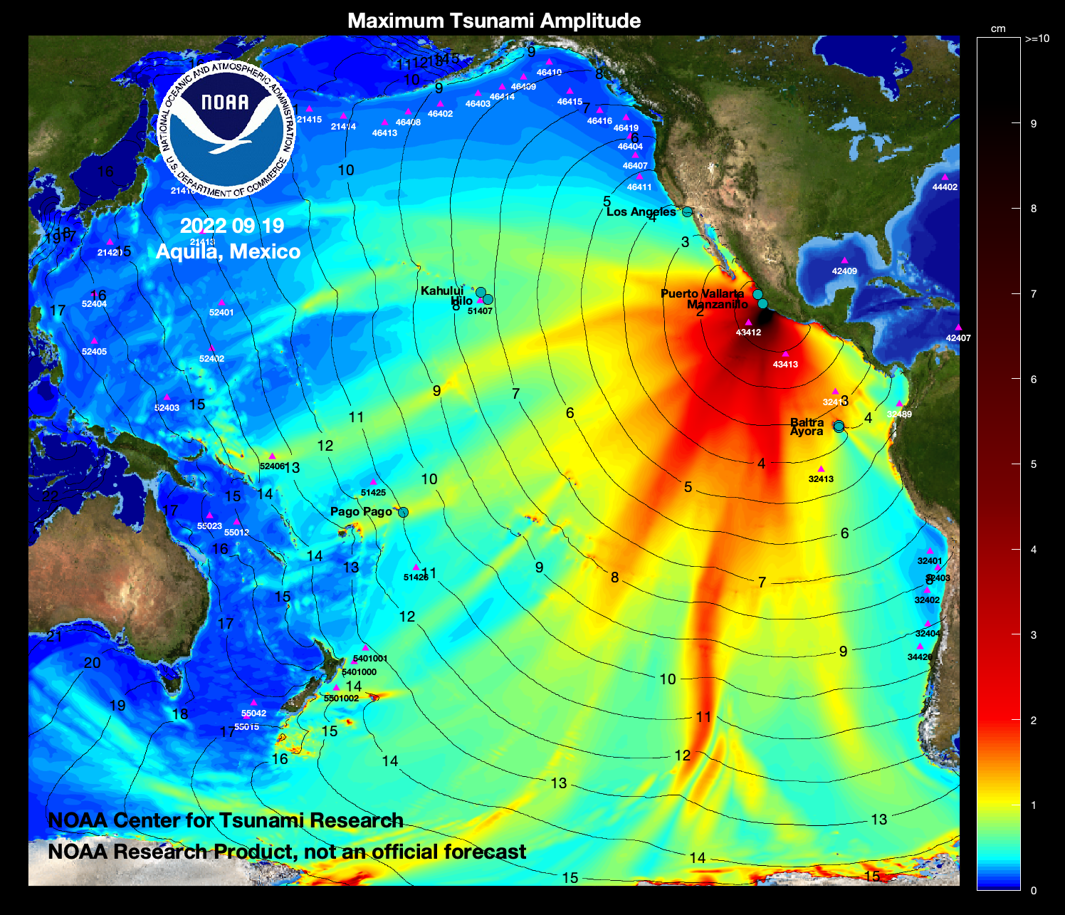
- Model amplitudes are calculated with the MOST forecast model. Filled colors show maximum computed tsunami amplitude in cm during 24 hours of wave propagation.
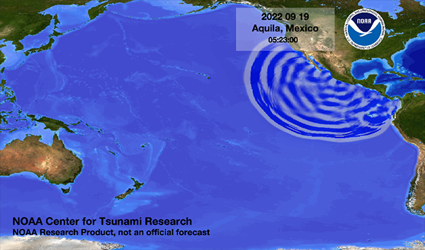
 Propagation animation on YouTube
Preliminary Model
Comparison of the September 19, 2022 Mexico tsunami recorded at tsunameter/DARTs and tide gauges with model results computed using the DART-inverted (red) source. The DART model time series are obtained from the pre-computed generation/propagation forecast database in real time, after automatically fitting models to tsunami records from the DARTs.
- DART® comparisons with model data

- Coastal sea-level gauge comparisons with model data
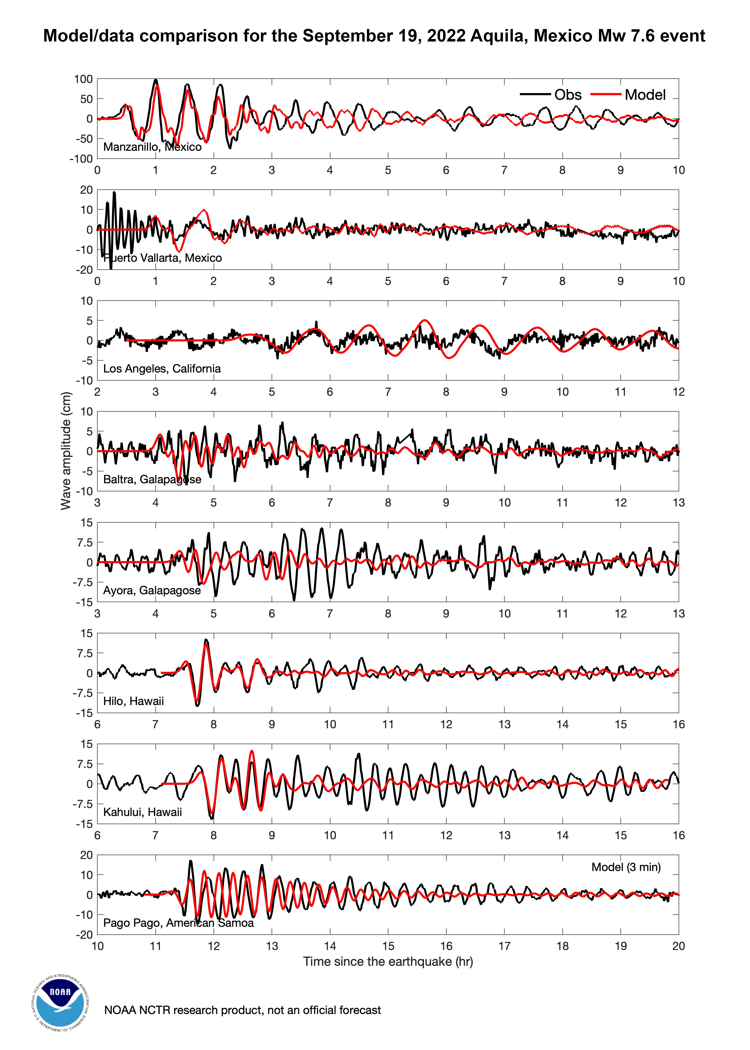
- Source: 1.96383*cs6a+0.21346*cs6b
It is noted that all above model results are preliminary. The tsunami source is estimated from inversion of observed waveforms at DARTs using a limited number of unit sources. The discrepancies between model results and tide gauge observation are mostly due to the limited knowledge of the earthquake/tsunami source configuration at this point.
Disclaimer: The models on these pages show the results of ongoing research to enhance tsunami science and to improve NOAA operational tsunami forecasts. These products were developed during or shortly after the tsunami event, are intended for research use, and are not an official forecast. They should not be used as the basis of any public or private policy decisions. Please contact NCTR to find if there are more detailed follow-on analysis results.
For media inquiries:
When using information from this page, please credit NOAA / PMEL / Center for Tsunami Research