Not an official forecast
Sand Point, Alaska Tsunami, October 19, 2020
Main Event Page
|
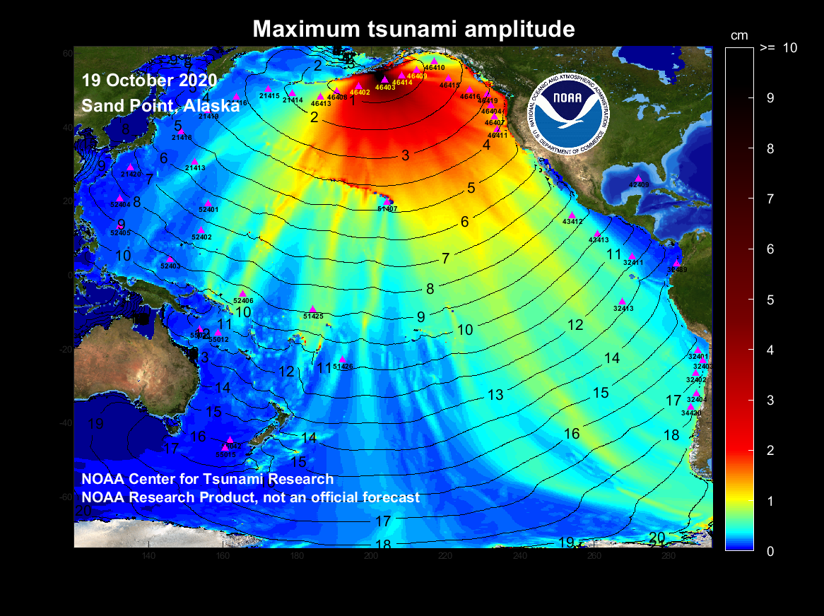
The October 19, 2020, Sand Point, Alaska tsunami was generated by a Mw 7.6 earthquake (54.617°N 159.635°W), at 2020-10-19 20:54:39 UTC (according to the USGS). The earthquake generated a tsunami that arrived approximately 18 minutes later at the closest DART 46403, located approximately 290 km away from the epicenter. The proximity of DART 46403 to the epicenter resulted in the tsunami signal being contaminated by seismic noise. While DART 46403 has DART 4G capabilities, meaning it should have been able to filter the tsunami signal from the seismic noise, those capabilities were not activated at the time of the event. The next available DART buoy to detect the tsunami was DART 46402, showing a maximum wave amplitude in deep water of just above 5 cm approximately 40 minutes after the earthquake. A DART inversion was performed with data from DART 46402 and DART 46403. The largest coastal tsunami amplitude was ~74 cm and was detected at the Sand Point tide station 2 hours 15 minutes after the earthquake. Model results shown below were created with the NOAA forecast method using the MOST model via inversion of the source with NOAA's TFS (Tsunami Forecast System). The graphics display preliminary modeling analysis, showing qualitative and quantitative information about the tsunami, including tsunami wave interaction with ocean floor bathymetric features, and neighboring coastlines. Tsunami model amplitude information is shown color-coded according to the scale bar.
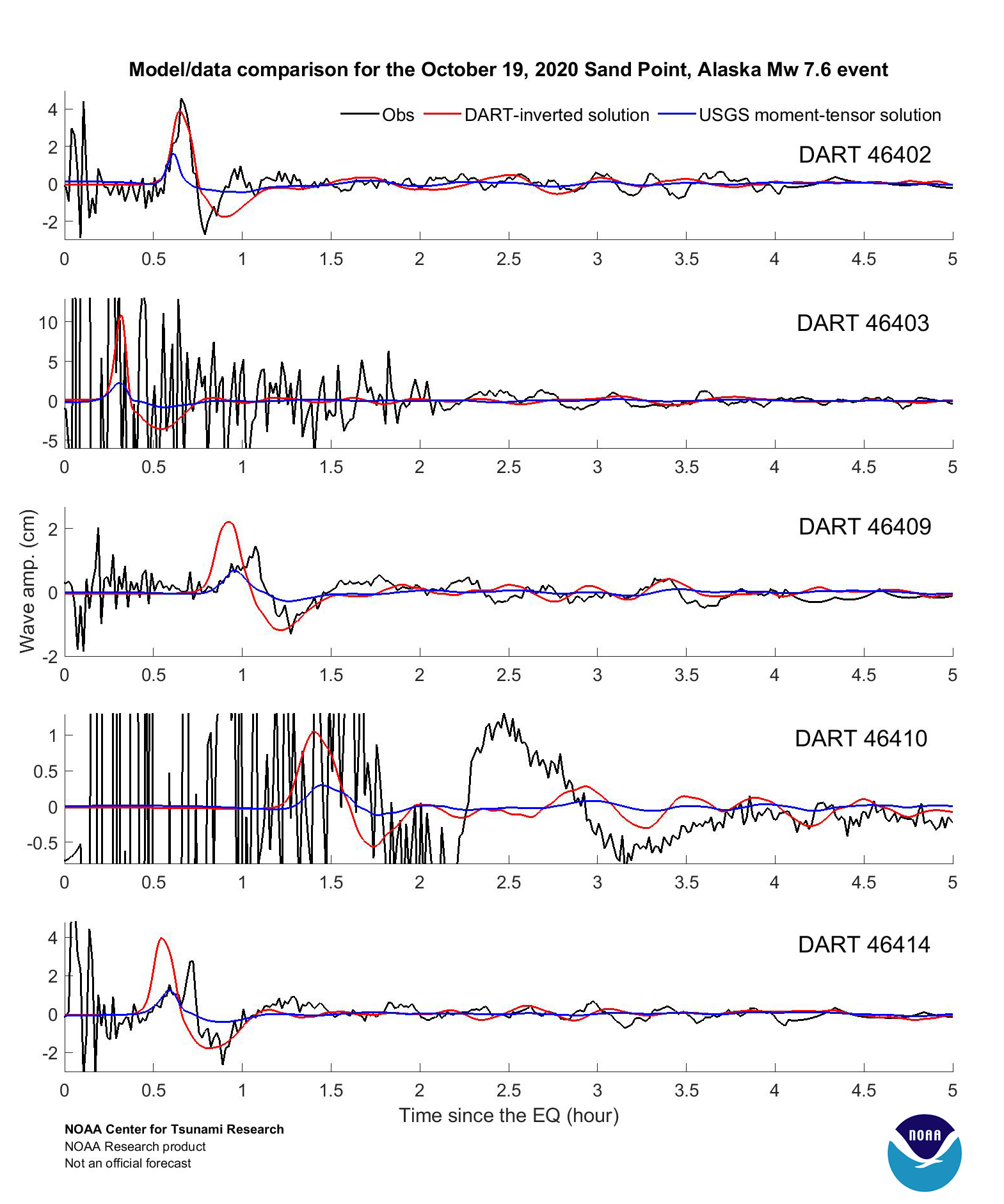
Preliminary Model Comparison of the October 19, 2020 Sand Point, Alaska tsunami recorded at tsunameter/DARTs and tide gauges with model results computed using the DART-inverted source (red) and the USGS moment-tensor solution (blue) is presented in the graphics. The DART model time series are obtained from the pre-computed generation/propagation forecast database in real time, after automatically fitting models to tsunami records from DARTs 46402 and 46403.
It is noted that all above model results are preliminary. The tsunami source is estimated from inversion of observed waveforms at DARTs using a limited number of unit sources. The discrepancies between model results and tide gauge observation are mostly due to the limited knowledge of the earthquake/tsunami source configuration at this point. |
||||
Disclaimer: The models on these pages show the results of ongoing research to enhance tsunami science and to improve NOAA operational tsunami forecasts. These products were developed during or shortly after the tsunami event, are intended for research use, and are not an official forecast. They should not be used as the basis of any public or private policy decisions. Please contact NCTR to find if there are more detailed follow-on analysis results.
For media inquiries:
When using information from this page, please credit NOAA / PMEL / Center for Tsunami Research