Not an official forecast
Cape Mendocino, California Tsunami, December 5, 2024
Main Event Page
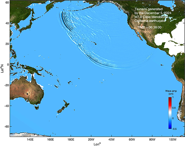
The December 5, 2024, Cape Mendocino, California Tsunami was generated by a Mw 7.0 earthquake that occurred on 2024-12-05 18:44:21 (UTC) with epicenter at 40.374°N 125.022°W (according to the USGS). A tsunami warning was issued by the National Weather Service (NWS) National Tsunami Warning Center Palmer, AK for the northern California and Oregon coast covering around 500 miles of coastline. During the tsunami warning period some population was evacuated and service canceled: the San Francisco Zoo was closed, with guests being evacuated and animals secured, schools in Pacifica and Arcata were evacuated, the San Francisco Bay Area Rapid Transit District (BART) stopped traffic in all directions through the underwater tunnel between San Francisco and Oakland. The warning was canceled by the NWS at 19:54 (UTC). The tsunami generated by the December 5, 2024, Cape Mendocino earthquake reached the closest California coast within minutes, but did not exceed 10 cm at any sea-level stations. The tsunami triggered the closest DART 46411 (39.337°N 127.040°W), the tsunami signal was detected with very small amplitudes that were barely distinguishable from the ambient noise, implying small-amplitude tsunami.
The graphics below display preliminary near-real-time modeling analysis, showing qualitative and quantitative information about the tsunami, including tsunami wave interaction with ocean floor bathymetric features, and neighboring coastlines.
![]() Propagation animation on YouTube
Propagation animation on YouTube
Maximum Tsunami Amplitude
- Model amplitudes are calculated with the MOST forecast model from the USGS W-phase Moment Tensor solution. Tsunami maximum amplitude information is shown color-coded according to the scale bar. Contours indicate the front of the modeled tsunami every hour of tsunami propagation.
- Maximum wave amplitude
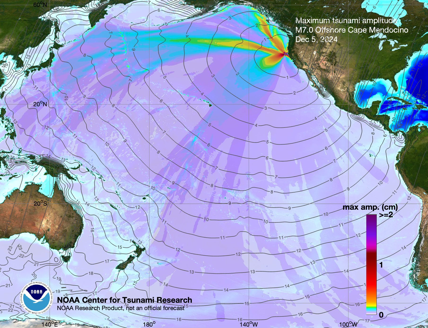
Preliminary Model
Two types of model assessments were completed for this event:
(1) One model used the combination of the closest source from pre-computed generation/propagation forecast database as the model source. This model assumes preset source parameters, regardless of the actual earthquake mechanism and is only adjusted by measured sea-level at DARTs or elsewhere. The advantage of this approach is the speed of the forecast. The predictions can be obtained as soon as the first earthquake information is available, and can be quickly adjusted with real-time sea-level information to improve accuracy. If the earthquake mechanism is significantly different from the pre-set source, the amplitude forecast accuracy may be variable.
(2) Second modeling approach uses the USGS W-phase Moment Tensor-based solution. This solution becomes available significantly later after the initial earthquake detection. This source is a more detailed representation of the earthquake source. However, it cannot be adjusted quickly with direct tsunami observations. If the seismic source is significantly different from the tsunami source, the amplitude forecast accuracy may be variable, and not easily adjustable.
Comparison of the December 5, 2024 California tsunami recorded at tide gauges (black line) with model results obtained from the pre-computed generation/propagation forecast database in real time (blue) after the earthquake epicenter and magnitude became available, and with the USGS W-phase Moment Tensor solution (red) is presented in the graphics below.
- Coastal sea-level gauge comparisons with model data
- Composite plot (pre-computed generation/propagation forecast database, 0.2*ac65c)
- Tide gauges: Eureka, Crescent City, Arena Cove
- Composite plot (USGS W-phase Moment Tensor-based solution):
- Tide gauges: Eureka, Crescent City, Arena Cove
- Composite plot (pre-computed generation/propagation forecast database, 0.2*ac65c)
It is noted that all above model results are preliminary. The discrepancies between model results and tide gauge observation are mostly due to low-quality bathymetry data used for the simulations and the limited knowledge of the earthquake/tsunami source configuration during the time of the analysis.
Disclaimer: The models on these pages show the results of ongoing research to enhance tsunami science and to improve NOAA operational tsunami forecasts. These products were developed during or shortly after the tsunami event, are intended for research use, and are not an official forecast. They should not be used as the basis of any public or private policy decisions. Please contact NCTR to find if there are more detailed follow-on analysis results.
For media inquiries:
When using information from this page, please credit NOAA / PMEL / Center for Tsunami Research