|
|
| System Overview |
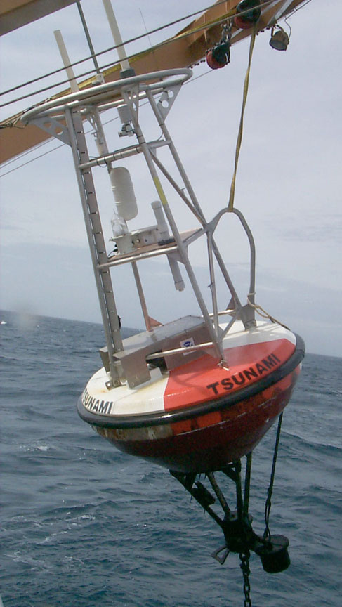
The Real-time tsunami buoy system is comprised of two parts: the bottom pressure recorder (BPR)
and the surface buoy with related electronics. The BPR monitors water pressure with a resolution of approximately 1 mm sea water with 15 second averaged samples. Data is transmitted from the buoy via an acoustic modem, and data is transmitted from the buoy via the GOES Data Collection System. Under normal conditions (no tsunami) the BPR sends data hourly that is comprised of four 15-minute values which are single 15-second averages. The BPR can make up to 3 tries to get acknowledgment from the surface buoy that the data were received. The data is reformatted and sent via the GOES self-timed channel and displayed to show open ocean tides. This gives an hourly indication of the health and condition of the entire system. If data are not received from the bottom, the surface buoy uses the GPS derived buoy position for the self timed message. An algorithm running in the BPR generates predicted water height values and compares all new samples with predicted values. A complete description of this algorithm can be found here. If two 15 second water level values exceed the predicted values the system will go into the Tsunami Response Mode. Data will be transmitted on the Random channel (132) for a minimum of 3 hours, giving high frequency data on short intervals with 100% repeated data for redundancy for the first hour. Every GOES transmission will include the time of T=0, which is the time the second out-of-bound value was detected. Every Tsunami Response Model message also includes an ID that identifies the type of data and the time of the data in the message as minutes after T=0. When the time of the hourly self-timed transmission occurs during a Tsunami Response Mode, the BPR will send one-minute data, comprised of the average of four 15 second values, for the preceding two hours (120 values). If the ocean is still perturbed after the nominal 3 hours of the Tsunami Response Mode, the hourly self-timed transmission of 120 one minute averaged values will continue. The system will return to normal mode only after 3 hours of undisturbed water heights. All Tsunami data use a simple data compression scheme. The first data value is the full water column height in mm of sea water. The following values are signed, 16 bit numbers representing departures from the full values in mm of sea water. |
| |
||
| DART | Background | Mooring System | Site Histories | References | Realtime Data | Home | ||
| NOAA | Pacific Marine Environmental Laboratory 7600 Sand Point Way, Seattle, WA 98115 Questions or Comments? | Disclaimer | Privacy Policy | ||