 | |
|
Eddie Bernard, Frank González and Hugh Milburn
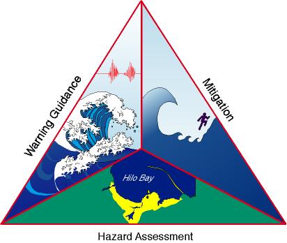
The National Tsunami Hazard Mitigation Steering Group Goal A State/Federal partnership created to reduce the impacts of tsunamis |
 |
|
Accomplishments | ||
|
Hazard Assessment
|
Warning Guidance | |
|
• Tsunami inundation
maps prepared for Oregon and Washington Maps identifying the areas of likely tsunami flooding for at-risk communities are being constructed to guide local tsunami hazard planning. The tsunami inundation map for Newport, Oregon, shown here, was created using a combination of numerical models and tsunami scenarios. The Center for Tsunami Inundation Mapping Efforts (TIME) was created to assist the states in evacuation map production. |
 |
• Deployed two real-time tsunami
• Formulated plan to upgrade seismic detectors networks in Alaska, California, Oregon, Washington, and Hawaii  |
 |
Mitigation
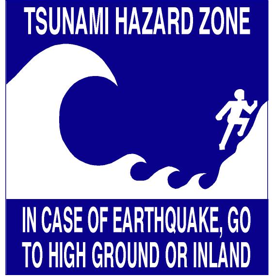
• Completed inventory of mitigation material
• Established mitigation plans for Alaska,
California, Hawaii, Oregon, and Washington Tsunami mitigation tools are being developed for the
states and local communities based on an evaluation of needs and an assessment of existing products. These signs have been adopted by the Steering Group as appropriate signage for coastal communities. |
Tsunami warnings will be improved through the installation of an array of deep ocean tsunami detectors and a major upgrade of existing earthquake detection networks. The locations of the oceanic sensors and land- based seismic sensors are identified on this map. These sensors will provide faster, more accurate estimates of tsunamis. |  |
|
Future Directions | ||
|
Hazard Assessment
• Prepare tsunami inundation maps for
Alaska, California, and Hawaii |
Warning Guidance
• Deploy next-generation tsunami detectors
• Install new seismic stations in Alaska,
California, Oregon, ;and Washington |
Mitigation
• Implement mitigation plans for Alaska,
California, Hawaii, Oregon, and Washington |
|
Funding for this research was provided by NOAA/OAR
PMEL 1998 Program Review - http://www.pmel.noaa.gov/programs/98prog-agenda.html | ||