Map of Sissano Mission
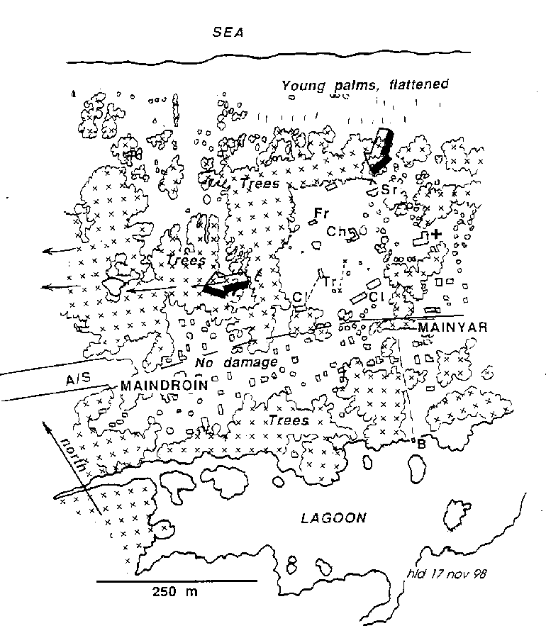
The map shows the pattern of damage at Sissano Mission and the path taken by most of the water (arrows). The wave broke on the beach and flattened young coconut palms, then swept southwestwards across the open ground of the mission destroying the priest's and sisters'residences (Fr, Sr), the church (Ch), an adjacent cement- block water tank, and a storeroom.
A one-and-a-half-tonne tractor (Tr) was carried 60 metres and a two-storey classroom building floated 55 metres into some coconut palms then collapsed to one-storey (the western Cl).
Dashed lines mark the trails of the tractor and the classroom building. The clinic (+) was damaged but left standing as water 2 m deep swept through from the northeast.
Most of the water then flowed westward into gullies north of the airstrip (A/S) leaving the houses of Mainyar and Maindroin undamaged. Survivors who had gathered at the boat landing (B) were unhurt.