Shunichi Koshimura
Tsunami Research Program,
Pacific Marine Environmental Laboratory, NOAA
Information URLs
Numerical modeling of tsunami
Numerical modeling of tsunami was performed by using TUNAMI code, provided by DCRC, Tohoku University. Bathymetry data used in this model is "Sandwell-Smith sea floor topography". Grid size is 2min. Seismic deformation modeling is based on the theory of Okada (1985).
[Earthquake mechanisms]
Model : HVD 1 (Based on Harvard CMT Solutions)
- Origin (Epicenter) = (17.41 S, 72.49 W)
- (Strike, Dip, Slip) = (152, 42, 108)
- (L,W) = (160 km, 46 km) *Estimated from empirical relationships between Mw and L/W [Wells and Coppersmith, 1994]
- Dislocation = 5.4 m
- Depth = 34.6 km (Originaly estimated 50.4 km as the depth of hypocenter)
Model : HVD 2(Based on Harvard CMT Solutions)
- Origin (Epicenter) = (17.41 S, 72.49 W)
- (Strike, Dip, Slip) = (308, 51, 74)
- (L,W) = (160 km, 46 km) *Estimated from empirical relationships between Mw and L/W [Wells and Coppersmith, 1994]
- Dislocation = 5.4 m
- Depth = 32.1 km (Originaly estimated 50.4 km as the depth of hypocenter)
Model : USGS 1 (Based on USGS Moment Tensor Solutions)
- Origin (Epicenter) = (16.14 S, 73.31 W)
- (Strike, Dip, Slip) = (284, 7, 45)
- (L,W) = (180 km, 52 km) *Estimated from empirical relationships between Mw and L/W [Wells and Coppersmith, 1994]
- Dislocation = 6.4 m
- Depth =5.8 km (Originaly estimated 9 km as the depth of hypocenter)
Model : USGS 2 (Based on USGS Moment Tensor Solutions)
- Origin (Epicenter) = (16.14 S, 73.31 W)
- (Strike, Dip, Slip) = (149, 85, 95)
- (L,W) = (180 km, 52 km) *Estimated from empirical relationships between Mw and L/W [Wells and Coppersmith, 1994]
- Dislocation = 6.4 m
- Depth =3.0 km (Originaly estimated 9 km as the depth of hypocenter)
[Seismic deformation modeling]
[Computed tsunami waveforms]
Note : Each model output is the offshore water level, at which the water depth is approximately 50 m.
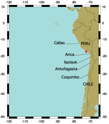
See this map for points of modeling output.
[Maximum tsunami height]
[Tsunami movies]
|