NOAA NCTR research product Not an official forecast |
Tsunami Event - February 27, 2010 Chile
Main Event Page
See ![]() Chile tsunami event video on YouTube
Chile tsunami event video on YouTube
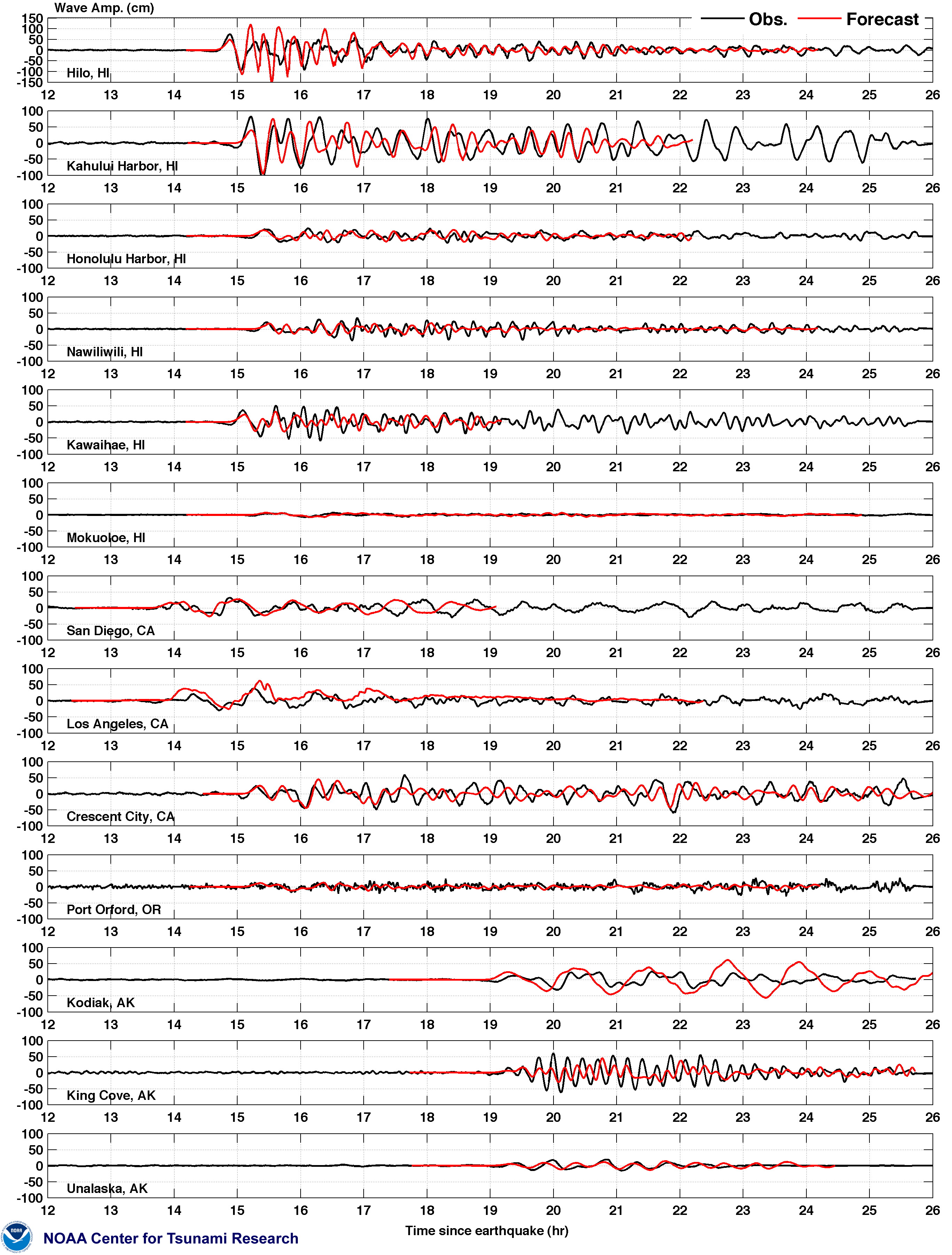
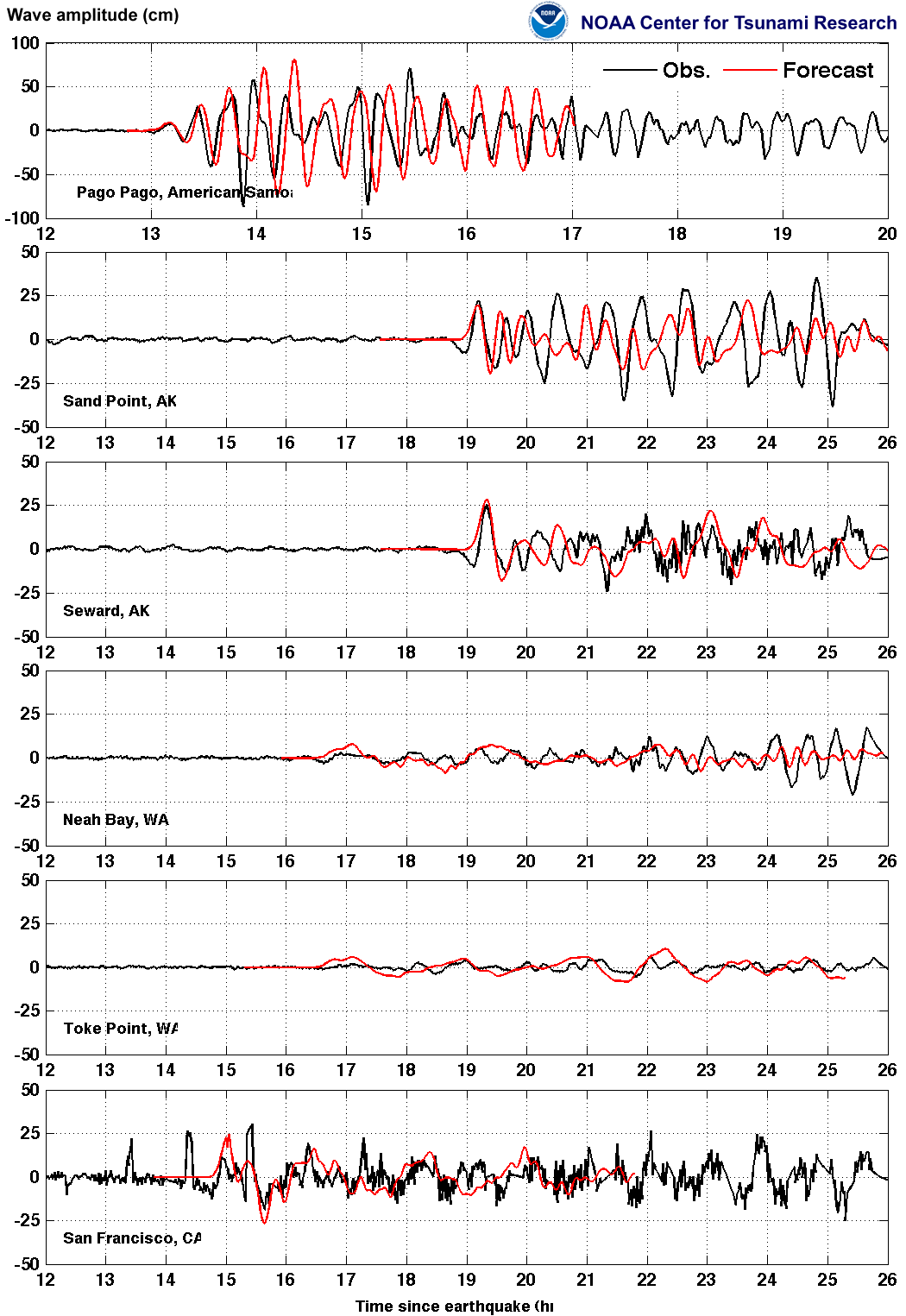
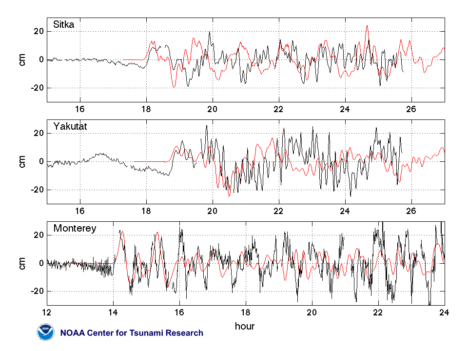
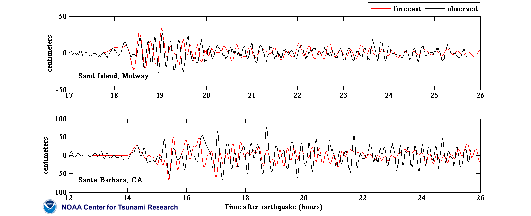
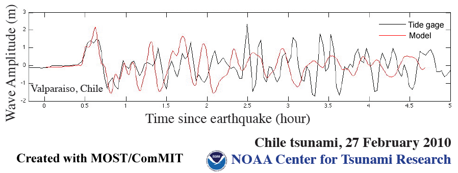
Local Valparaiso Modeling Results | Web Link Compilation | Model Data Comparison Plots The Chile tsunami was generated by a Mw 8.8 earthquake (36.122°S 72.898°W ), at 06:34:11 UTC, 115 km (60 miles) NNE of Concepcion, Chile (according to the USGS). In approximately 3 hours, the tsunami was first recorded at DART® buoy 32412. Forecast results shown below were created with the NOAA forecast method using MOST model with the tsunami source inferred from DART® data. The tsunami waves first arrived at Valparaiso, Chile (approximately 330 km northeast from earthquake epicenter ), at 0708UTC, about 34 minutes after the earthquake. |
||
The graphics to the left display forecast results, showing qualitative and quantitative information about the tsunami, including tsunami wave interaction with ocean floor bathymetric features, and neighboring coastlines. Tsunami model amplitude information is shown color-coded according the scale bar.
|
||
- New! Google map access to model - sea level data comparison plots
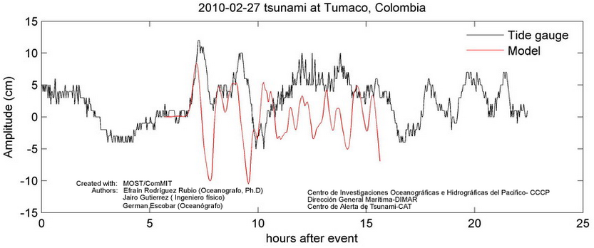
- Comparison of the February 27, 2010 Chilean tsunami recorded at sea-level gauges along U.S. coastlines with forecasts obtained from high-resolution forecast model runs. The forecast models were run in real time before the tsunami reached the locations shown. The model data for Hawaii and the U.S. West Coast show 9 minute early arrival (0.8-1% error accumulated during the propagation simulation). The plots show model data for those locations shifted 9 minutes later for the comparison purposes. (see References, below)
- Forecast results comparison with sea level data composite plots (available individually from Google map):
- Unit Sources: 17.24*cs88a+11.86*cs88b+20.78*cs88z+18.39*cs89b+16.75*cs90b+7.06*cs90z
Disclaimer: The forecasts on these pages show the results of ongoing research to enhance tsunami science and to improve NOAA operational tsunami forecasts. These products were developed during or shortly after the tsunami event, are intended for research use, and are not an official forecast. They should not be used as the basis of any public or private policy decisions. Please contact NCTR to find if there are more detailed follow-on analysis results.
For media inquiries:
When using information from this page, please credit NOAA / PMEL / Center for Tsunami Research